Deadly Sushi
The One, The Only, Sushi
If you have Google Earth installed Here is a treasure hunt!!!
69;29'11.26 110;19'45.64
Click and tell us what it is!
69;29'11.26 110;19'45.64
Click and tell us what it is!


<snip>
Also, Bob, your pointer coords in the lower left seem to be way off the coOrdinates I gave.
I can't see a damn thing at all worth commenting about. It's either someplace in Russia, or a lake on Victoria Island in Canada. Depends on if you use east or west longitude.
I went due south around the globe, nothing in that line even remotely familiar, that is saying GE is working right
I ended up in Northern Canada, in the Middle of a Black lake at:
69.29'11.26 110.19'45.64
I suppose the treasure is either oil or dimonds... Lumber is a bit scarce up that direction....
")

Make sure you can see those blue "i" symbols.
Come on. Im not going to tell you whats there. I cant give you anymore clues.
Go to those coords, and click on the blue "i" there.
Well, if your first post had actually said 64 degrees north instead of 69 degrees north, we might have had a better chance of figuring it out. The blue I has nothing to do with it, it's because you told us to look 350 miles away in the wrong spot.

Originally Posted by Fogtender
I ended up in Northern Canada, in the Middle of a Black lake.
I suppose the treasure is either oil or dimonds... Lumber is a bit scarce up that direction....
Youre getting REALLY warm!!!

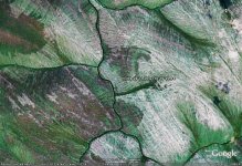
Is this it?
Attached Images


If you have Google Earth installed Here is a treasure hunt!!!
69;29'11.26 110;19'45.64
Click and tell us what it is!
 I wrote down the exact coordinates that my cursor was over. If you go and put your cursor over the blue "i" it will show what I wrote.
Ok Sush, here are your boo-boos.
1. Anyone cutting and pasting your coords into GE will get an error because GE does not recognize ";" as a separator between degrees and minutes.
2. Your longitude of 110 should have been either -110 or W110, else you end up on the other side of the world.
3. It shoud have been 64 not 69! What were you thinking? Oh, 69, nevermind.
 You just have to think like Sushi. What are you an engineer or something?
 Good thing is, there arent any photos on THAT. Just the chairs they placed them on. Ok....... Good Luck!
No. Where is the fun in that???Got to >Tools>Options and set your coordinate system to 'degrees decimal'. Then peeps can cut and paste your coords without getting an error.
I haven't seen any mapping system that uses ';' as a delimiter between degrees and minutes, including GoogleEarth.